
Newburyport is one of the more bustling towns in the North Shore. Its downtown, named Market Square Historic District, sits along the Merrimack River and was once the meeting place for Native Americans to trade furs and fish with the early explorers from Europe. Now the commerce center of the town, it provides all the food and shopping options you could want for a whole day of browsing/buying/tasting. Most of the stores are locally owned and cater to the tourist crowd, but there is also a variety to their wares – from kitchen to pet, from chocolate to oysters, from boutique to beach fashion – there’s a little something for everyone. The whole historic downtown area is housed in a row of red brick buildings providing a uniform charm to the city.


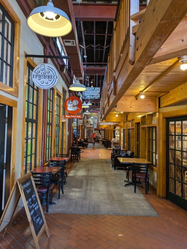
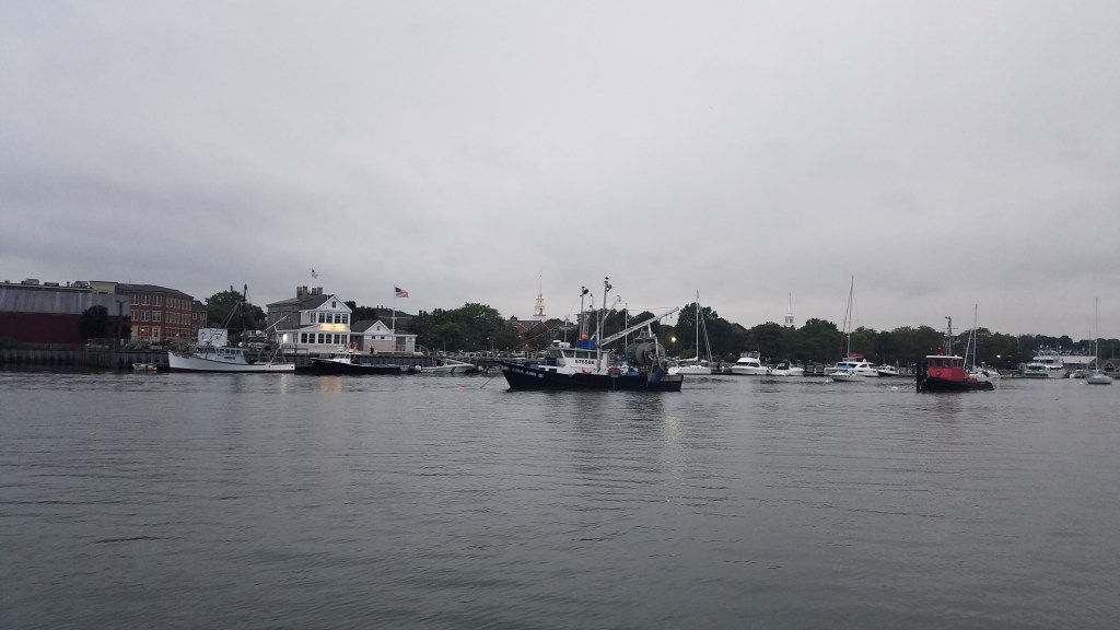
Along the Merrimack River is a lovely harbor walk with swings and benches to enjoy the boat activity in the harbor, and flowers and a sculpture garden to add to the beautiful vistas. It also connects the historic downtown to Tannery Marketplace – a set of five mill buildings repurposed for shopping and business centers. The interior of these buildings are just as interesting to see as the wares that the stores offer.

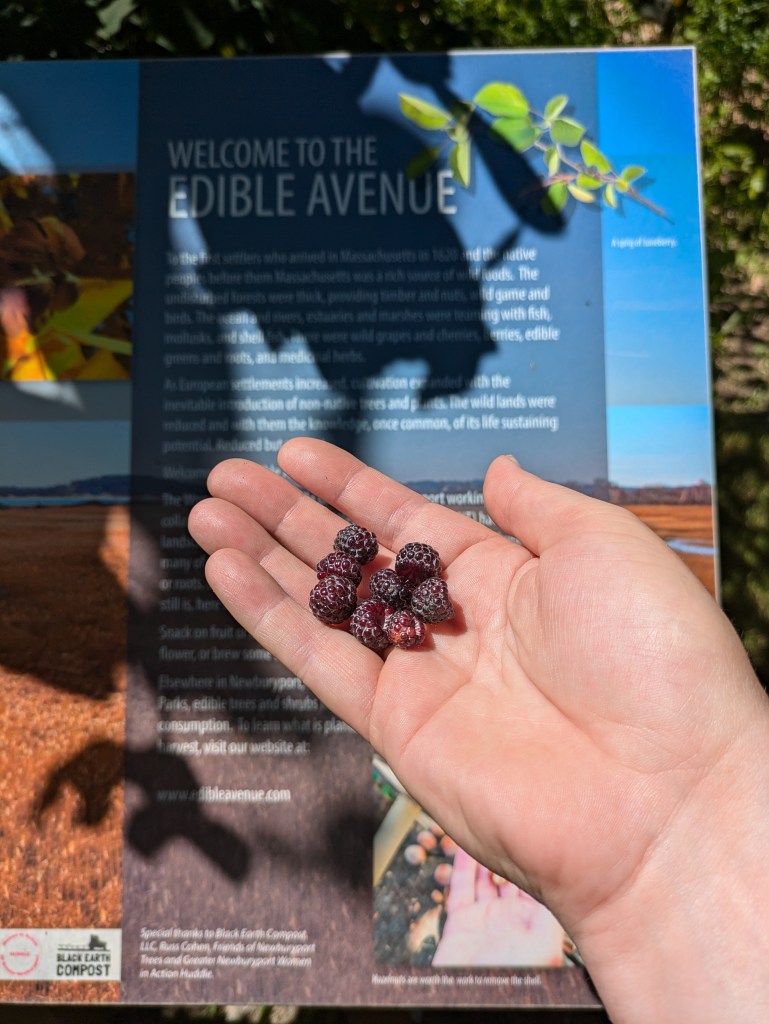
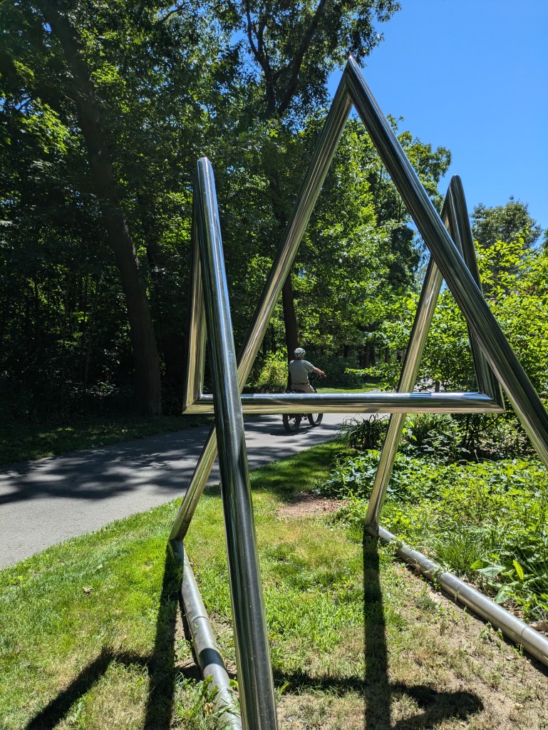
The harbor walk connects to the Clipper City Rail Trail. While this bike/walking path is only 3.3 miles long, it serves as a connection between the commuter rail and the downtown area. The trail features art sculptures that blend seamlessly with the nature of the trail, and an “Edible Avenue” encourages the public to learn about native food sources as well as even taste some – if the berries are in season.
One year my friend booked a sunset river cruise for her birthday. The 90 minute cruise hosted by Yankee Clipper Tours left from Newburyport harbor and took us up the Merrimack river away from the bustle of the harbor to the more serene natural beauty of the river. It ended up raining the day we went, so we didn’t get to experience a sunset, but since the boat is covered, we were still able to enjoy the ride. With snacks, drinks, and some live music from some friends, it was a lovely way to celebrate a birthday.

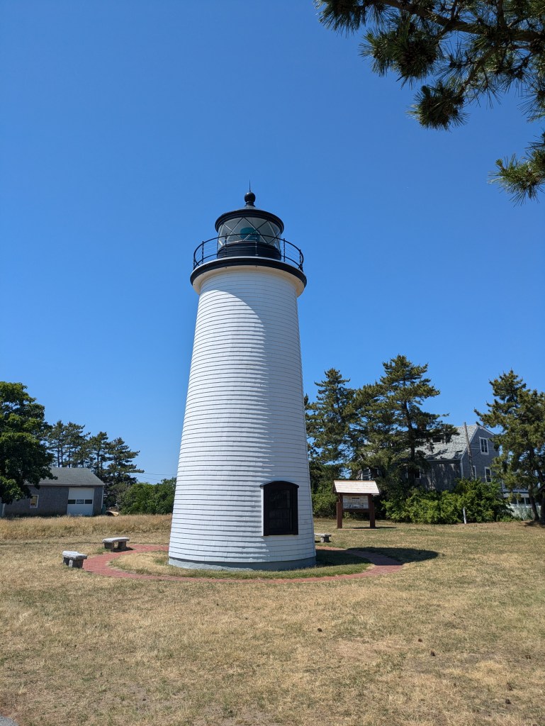
Just outside the downtown area is Plum Island. This barrier island has two sides to it. The north side of the island is built up with beach cottages and a few shops & cafes for those that have a place on the island. There is very little public parking here, so unless you have a place to stay, the most you can do is drive around. I have driven all the way to the end to see Plum Island Light, which I was surprised to find is actually sitting in the middle of a park, not on the coast. The lighthouse is under the guardianship of the Friends of Plum Island Light, who offer tours to the public only six days of the year, so if you’re interested in seeing inside the lighthouse, make sure to check their schedule before going. Otherwise, there are informational plaques around the park to check out; however, I couldn’t find any real parking while I was there, so I just took a quick picture and kept driving.
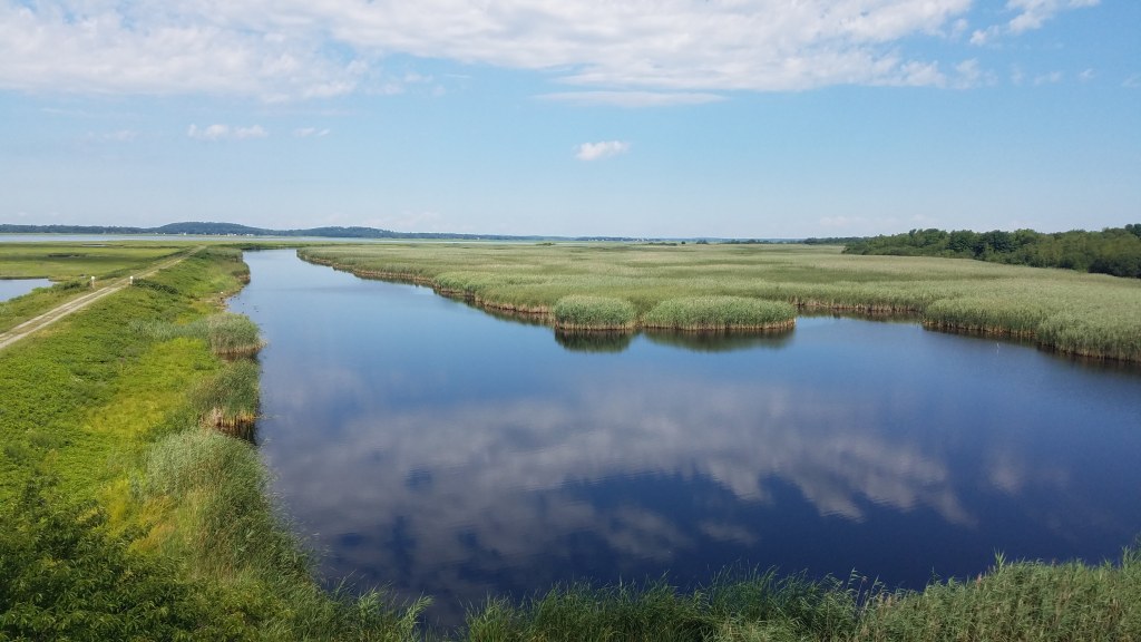
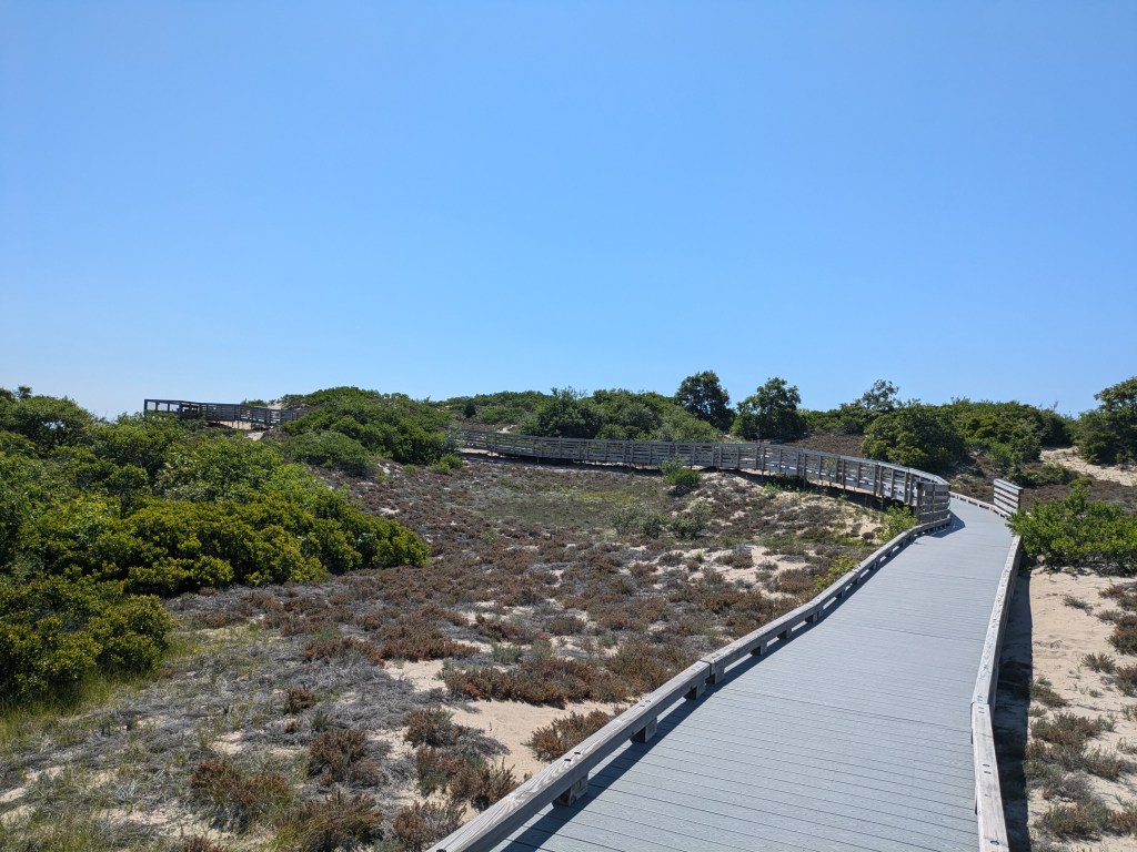
The south side of Plum Island (and the majority of the island) is all about nature. The majority of it is run by the Parker River National Wildlife Refuge. They watch over over 4,700 acres of wetlands and uplands. If you had a boat (non motorized), exploring the sea marsh here would be a great way to see birds, fish, and amphibians. I have only ever explored the refuge by land. There is one road that takes you from the entrance to the end of the island. Along the way, there are shoulders for birdwatching and parking areas for hiking trails, which provide short walks out to views of the salt marshes. The most popular one – for good reason – is the Hellcat Boardwalk trail. This 1.3 mile loop trail includes views of the salt marsh, dunes, and forest. It is easily accessible for most people and has a restroom at the parking area. This is also the end of the paved section of the road. Past here are a few more trailheads before the very end of the island, which is actually a Massachusetts State Park.
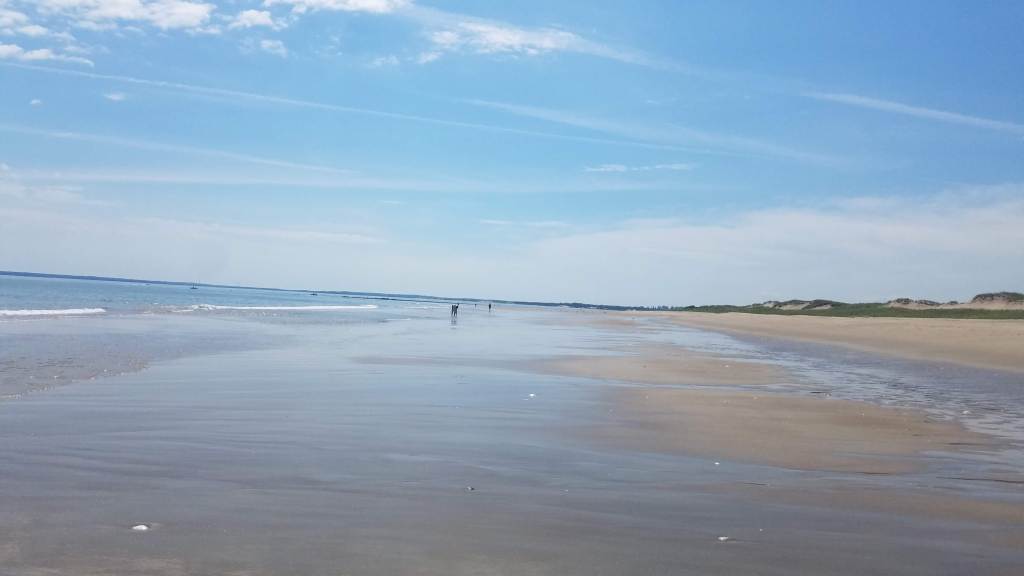
Sandy Point State Reservation is home to one of the quietest and smoothest beaches I’ve seen in the state. This is because it’s a long drive to get here and there aren’t many parking spots available. I got here at 9:30am, and there were only a few spots left. It is a beautiful shallow beach with views of Crane Beach across the way. More people arrive here by boat than by car as it is also at the head of the Ipswich river. I’ve had the privilege of arriving here both ways. Word of warning if you choose to go by boat: pay attention to the tide as the Ipswich River can become too shallow for travel pretty quickly. While I’ve only been here in the summer, I can imagine coming here in the off season for a long walk along the coast.

Leave a comment