
Cities can be overwhelming – especially New York City. The noise is jarring, the crowds are chaotic, and the buildings are massive. While I’m walking around NYC, I feel like all of my focus is on navigating my way through the hustle and bustle. It’s hard to get a sense of the city while immersed in the chaos of the streets. Looking up at the towering skyscrapers from the street level can make for some great pictures, but it’s difficult to get perspective of the vast area that the city takes up while inside of it.
For several reasons – one being great pictures – I enjoy spending some of my time in New York City on the water. I find that some of the best views are from just outside the city. For New York City, this means from the East River and Hudson River.
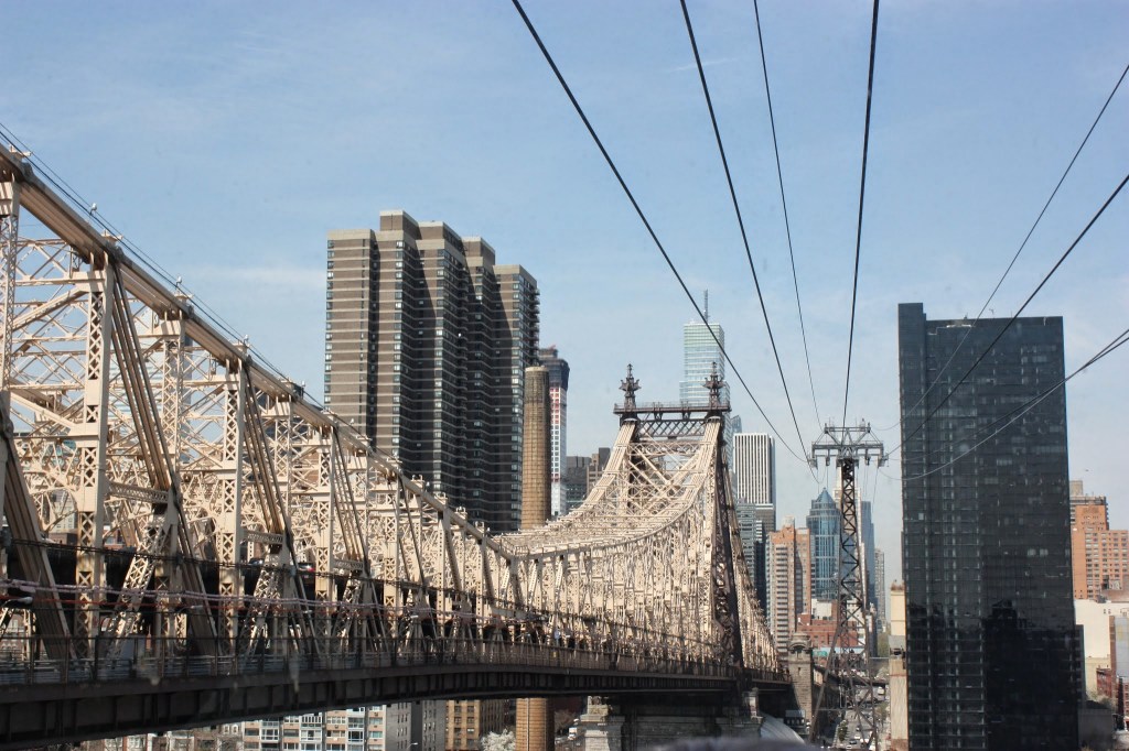
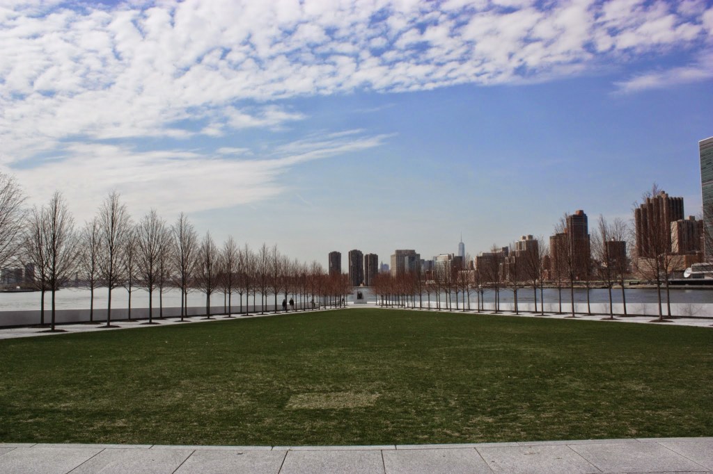
Roosevelt Island
At less than 2 miles long, Roosevelt Island dwarfs in comparison to the city. While the island, which is set between Queens and Manhattan in the East River, is accessible by the subway, taking the Roosevelt Island Tramway is part of the fun of the experience. Tram gives an aerial view of the city and the island.
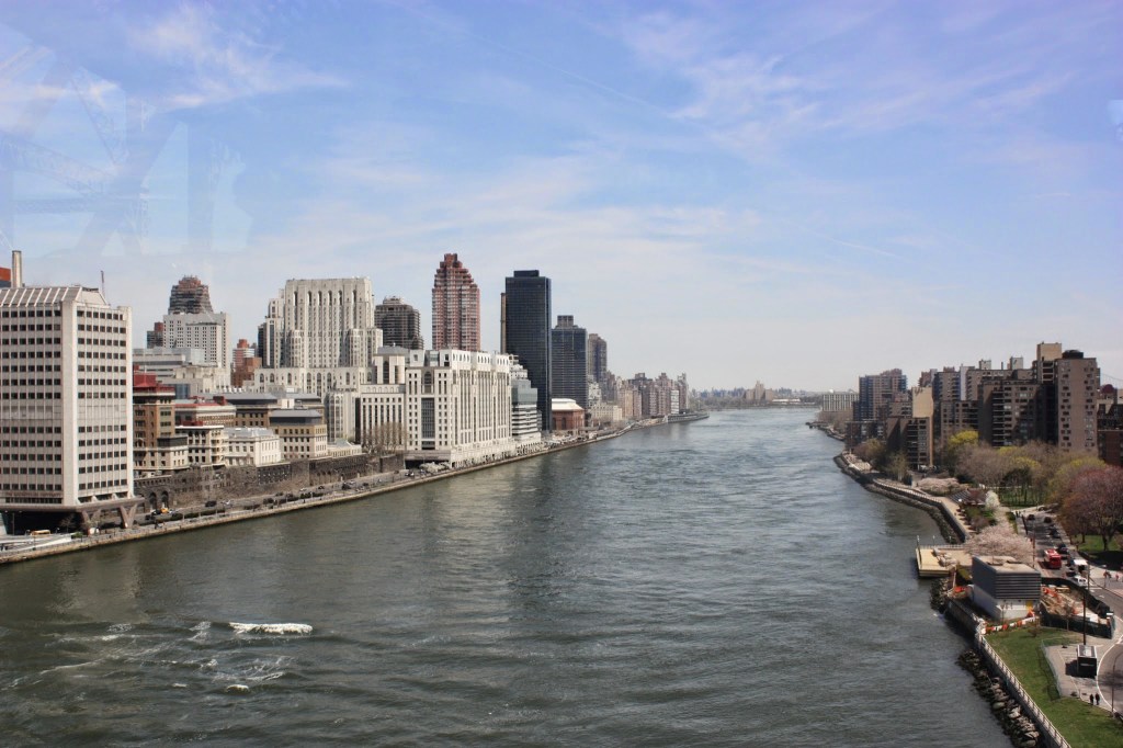
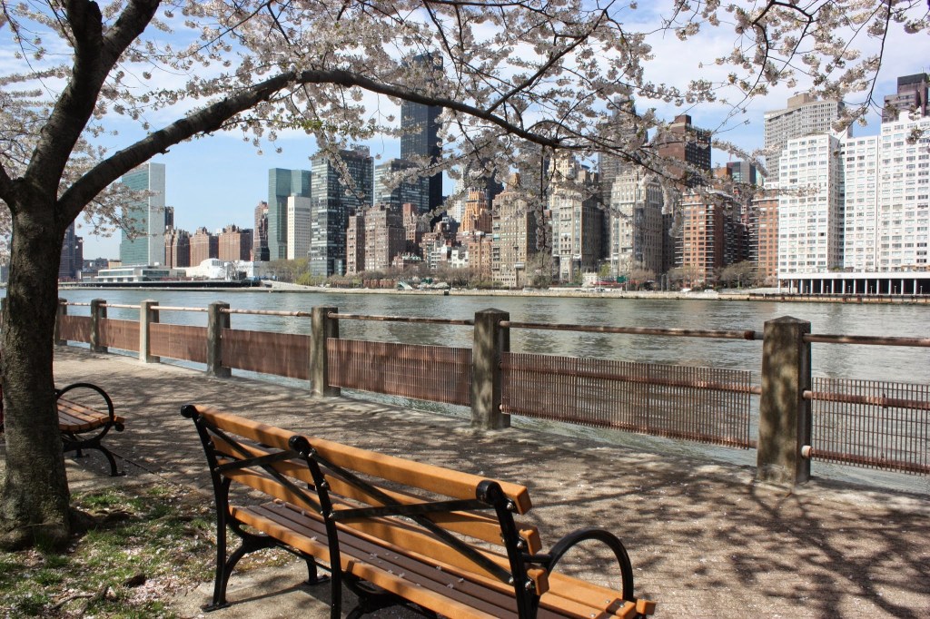
The island has a small residential community and a Cornell Tech campus mid island, but both the northern and southern ends of the island are dedicated to parkland. I spent a few hours wandering around the southern end to take in the vistas of the city and to visit two of the sights at this end of the island.
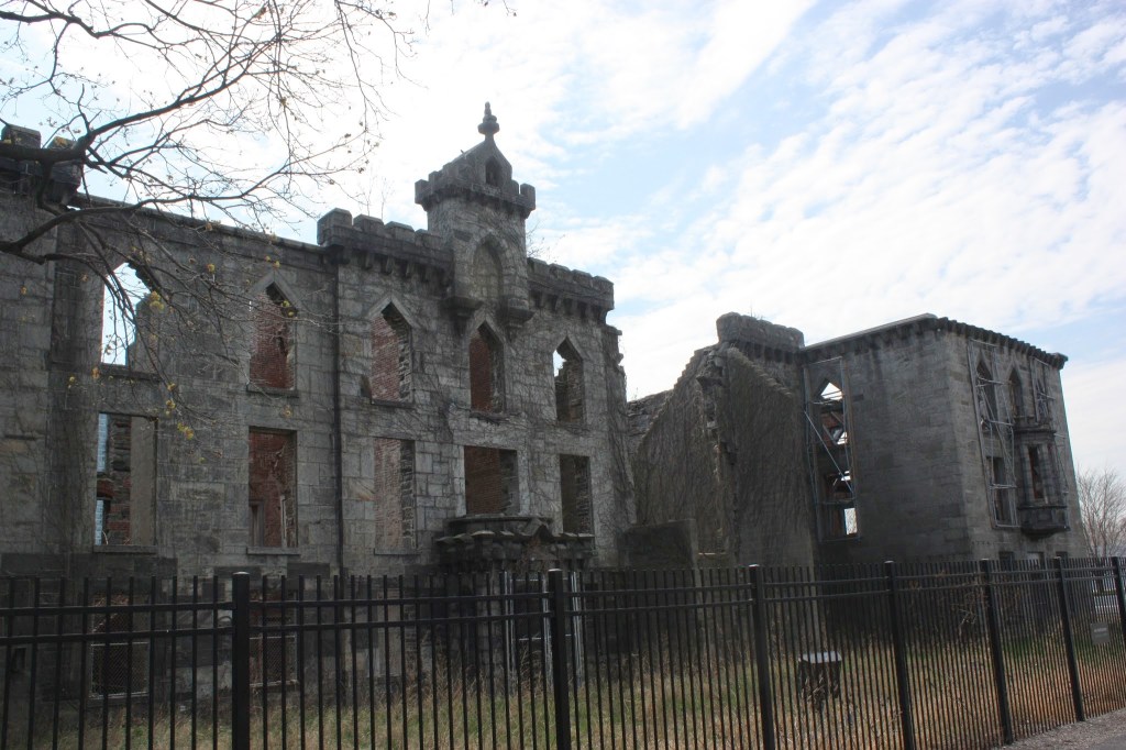
The island once held a Smallpox Hospital. The hospital was opened in 1856 and abandoned in the 1950s. In 1976 the building was designated as a New York City Landmark. Since then, ivy has scaled the deteriorating ruins of the building, and while the building has been stabilized, it is still off limits for exploring. In the last few years, the Friends of the Ruin have been fundraising to turn the hospital into a memorial for those lost during COVID-19 pandemic.
While walking towards Four Freedoms Park, the flanking flowering linden trees slowly narrow guiding me directly to the large bust of Franklin D. Roosevelt. Outside of the bronze bust, the monotone white granite slabs rise up on either side and pave the ground below.
East River Ferry
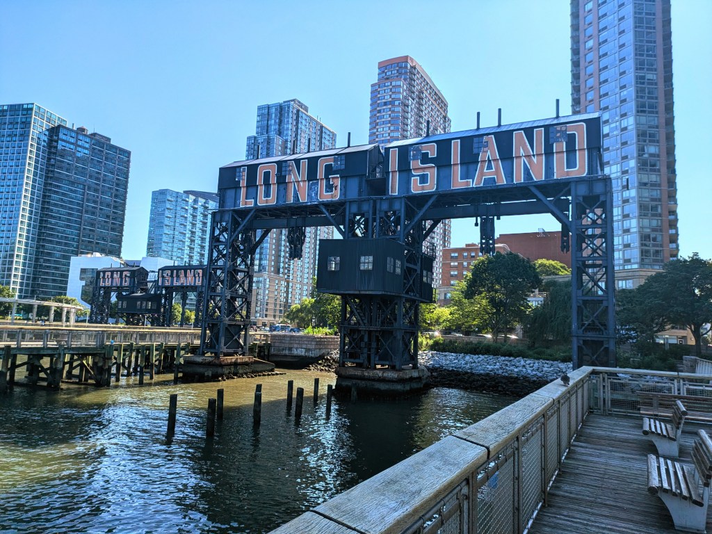
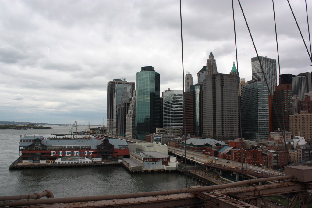
There are actually six ferry routes run by the New York City Ferry service, and five of the six of them traverse the East River. Since I was staying in Queens during my last visit, I started my ride on the East River Ferry from Hunter’s Point South. From here the ferry crossed the East River for a stop in Manhattan before crossing back over to the banks of Brooklyn for a few stops. The ferry provides sweeping views of the old factory signs and buildings in Brooklyn, the massive skyscrapers of Manhattan, and the marvels of the Williamsburg, Manhattan, and Brooklyn bridges.

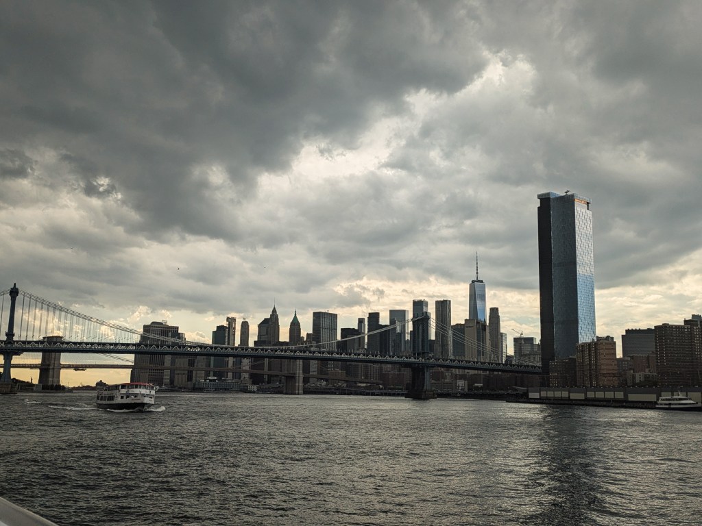
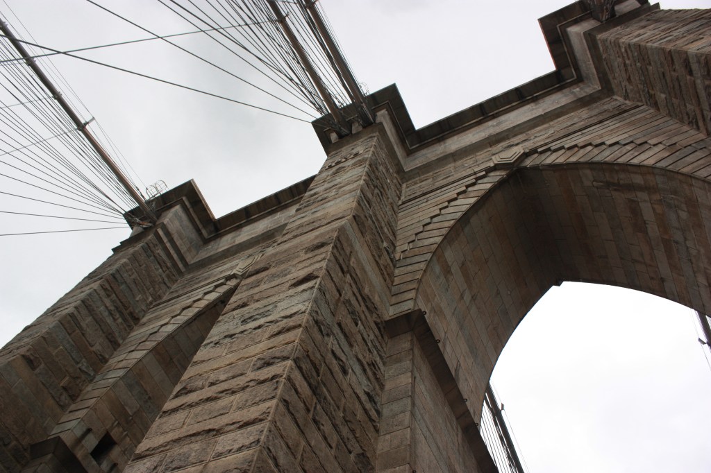
The last stop in Brooklyn is in DUMBO. Here I got off for my first adventure of the day. Standing for “Down Under the Manhattan Bridge Overpass,” it’s no surprise that the Manhattan bridge is an important part of this neighborhood; however, since the Brooklyn Bridge also looms over the neighborhood, both draw people to the neighborhood. There is a nice walkway and park just under the Brooklyn bridge, the iconic shot of the Manhattan bridge framed by Washington street cobblestones is just up the hill, and access to the Brooklyn bridge walkway is close at hand.

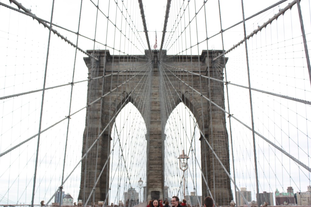
I can never pass up an opportunity to walk at least part of the Brooklyn bridge when I visit. The up close engineering of the bridge, views of the water, and ability to walk above the buildings provides a unique view I never get tired of.
While I have walked across the whole bridge and continued my adventures in Manhattan during other visits to the city, my final destination for today was Governor’s Island, so I made my way back to the DUMBO ferry dock and transferred to the South Brooklyn ferry route. After the ferry leaves the southern end of Manhattan, the ports become more industrial and raw. While this also meant a little smelly, I enjoy seeing the working side of the city as well.
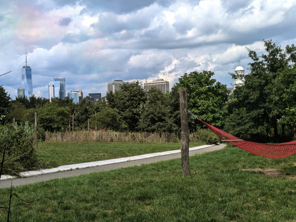
The history of Governors island is long and complex. Dutch colonists actually first settled here in the early 1600s before moving over to Manhattan. In the late 1600s, the island became the hub for the military – first for the British and later for the American armies. Until the mid 1990s it was solely a military post; however, in 1995, the island was transferred over to the city of NYC and it opened to the public in the early 2000s. Since then the island has been expanding its public space and diversifying its recreational options. Now, the island balances its military history with park land and artist communities. Fort Jay and Castle Williams offer tours and reenactments, a 2.2 mile paved road encircles the island and makes for a pleasant bike ride (there are Citibike and private bike companies to rent from), landscaped trails, playground features and hammock groves draw people into the quiet center of the island, and artist studios and food stalls add color to the experience. While I visited on a Monday, when a lot of the indoor spaces were closed, I found it easy to spend over 3 hours exploring the island. I would love to return to check out the indoor art galleries and historic buildings.


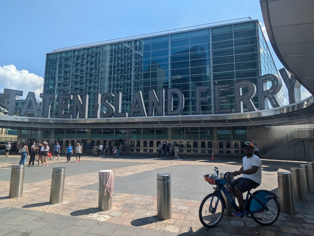
Staten Island Ferry
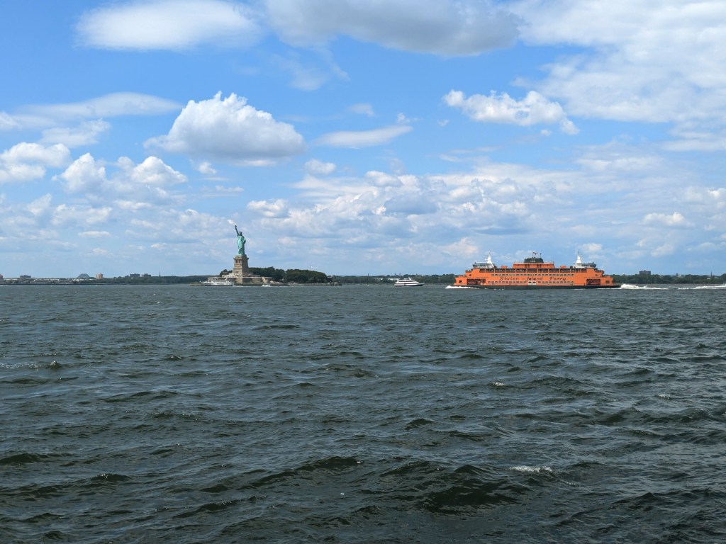
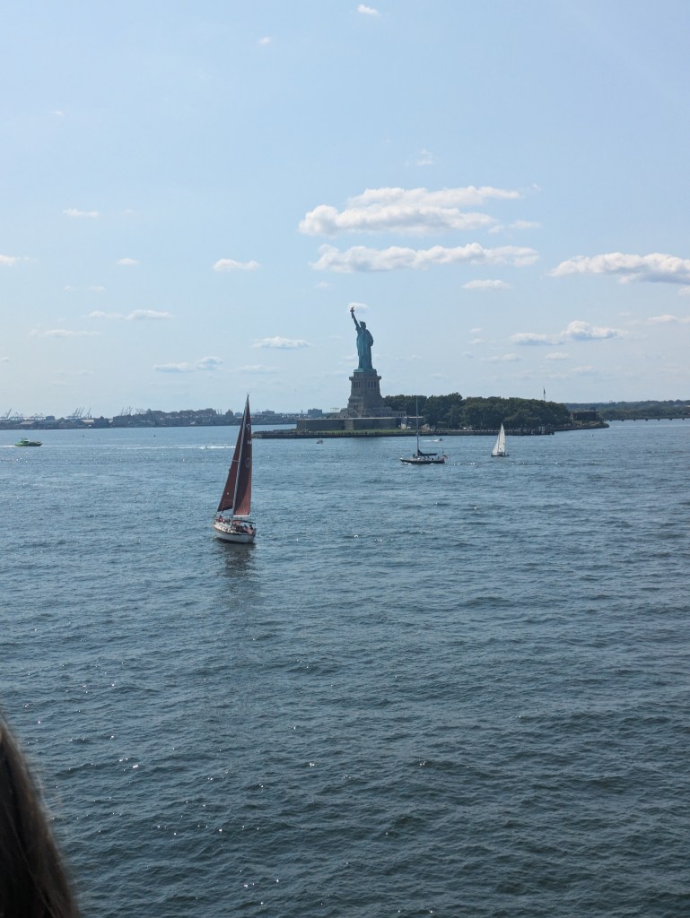
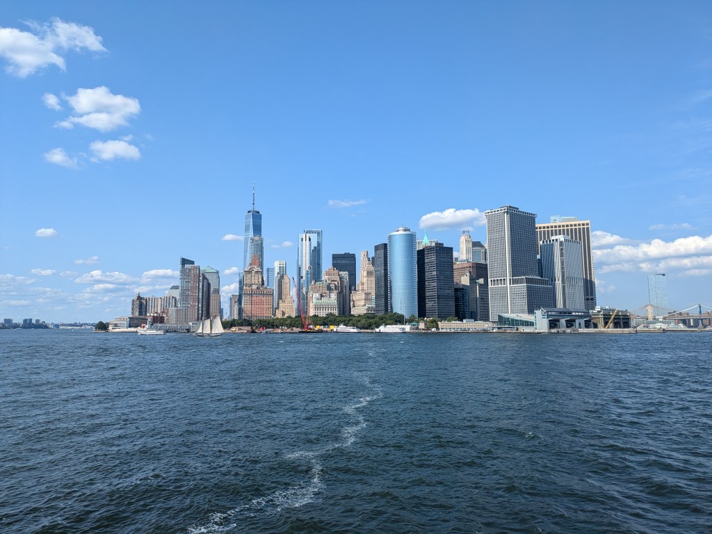
The Staten Island Ferry leaves from Battery park at the southernmost point in Manhattan and travels for 30 minutes across the water to Staten Island. This is in essence a commuter ferry, but because of its views along the way, it has become a huge tourist destination as well. The free ferry leaves every 30 minutes from Whitehall Terminal and passes the Statue of Liberty (on the right hand side going to Staten Island) during its 5.2 mile route to St George in Staten Island. While there isn’t much to see at the St George terminal, the views of Manhattan and the Statue of Liberty make this a worthy way to spend an hour or so.

Leave a comment