
Doolin feels like everything I ever expected Ireland to be. As a solo traveler who has never driven on the left side of the road, I decided to explore Ireland by public transportation. It was an easy 2 hour bus ride from Galway to Doolin, which passed some beautiful castle ruins on the way. If I had my own car or more time, I would’ve loved to stop and explore some of these castles, but that wasn’t in the cards for this whirlwind trip.

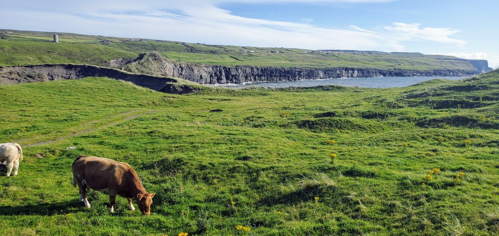
As soon as I arrived in Doolin, I dropped off my luggage at my accommodations and made my way down to the harbor for my trip to the Aran Islands. The walk down to the harbor was beautiful in itself as it passed the rolling vibrant greens of a golf course and cow pastures. The boat ride to Inis Oirr (pronounced Inishsheer) is a quick 15 minutes, where it docks in the village of Caherard.
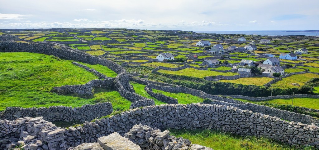
Inis Oirr, translating to “Little Island,” is the smallest of the islands at only 3 square kilometers, so it’s an easy island to navigate by foot, bike, or horse drawn carriage. Even though I thought three hours would be enough – and I was able to see a lot of the island in that amount of time – I wish I had budgeted a little more time just to sit and take in the energy of the place. The island’s residents (300 in total) maintain the culture and history of the island. Houses and the 20 acres of land per residence are passed down from generation to generation, so almost everyone on the island grew up on the island.

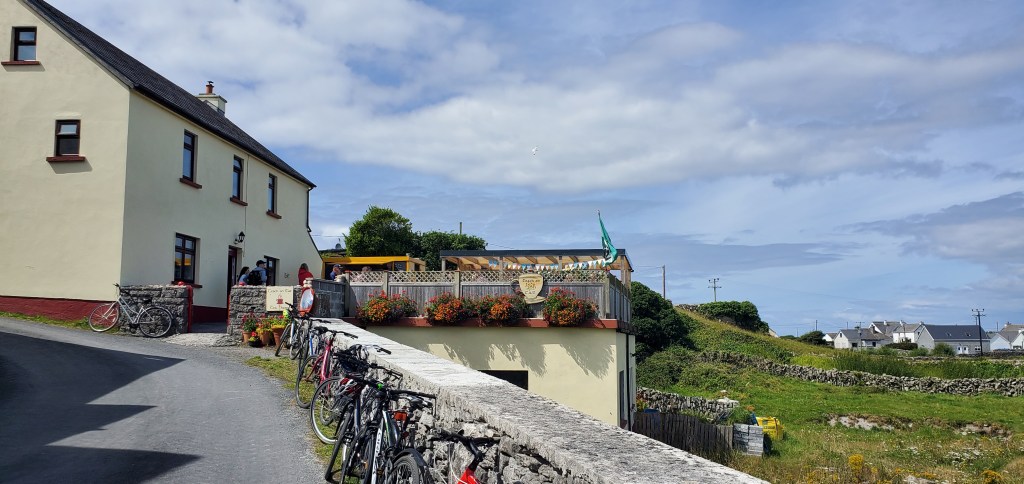
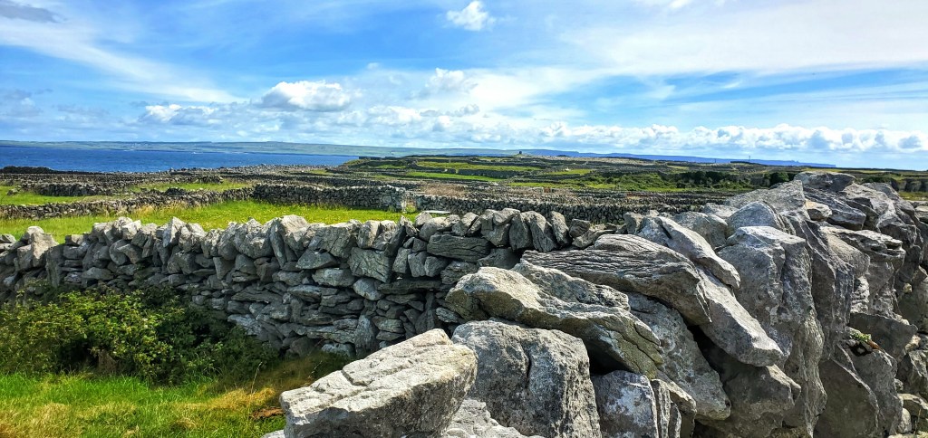
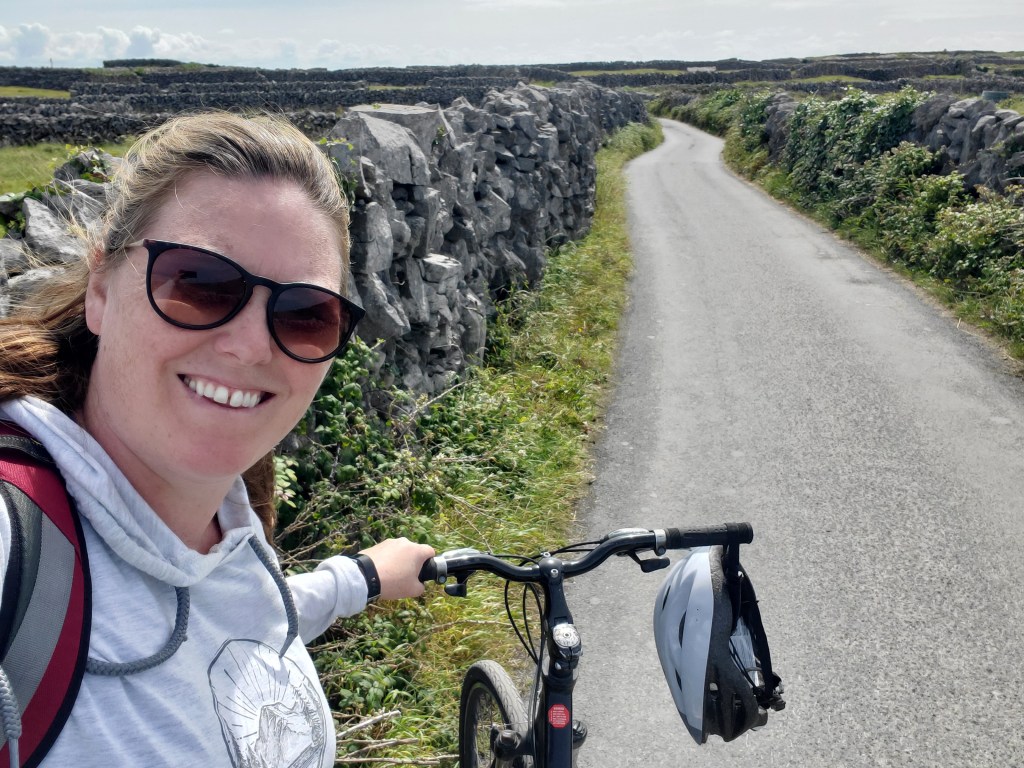
The main village center offers a few eateries and artisan shops and a pair of bike rental places. I picked one, and I was on my way. The roads are narrow and lined with the endless limestone rock walls that blanket the island. Most of these walls were constructed as a means of organizing the rocky terrain instead of serving as property lines – as one would think. If one was to line up all the rock walls of the island, they would span the entire country of Ireland. As I biked down the roads, I couldn’t help but stop to say hello to the livestock, marvel at the construction of the dry walls, and take pictures of colorful the white limestone, green grass, and blue water vistas.

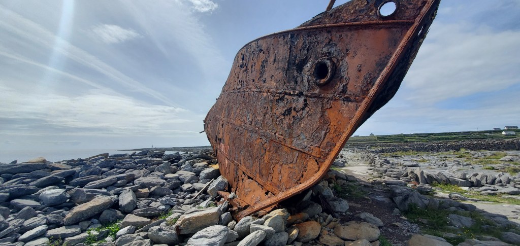
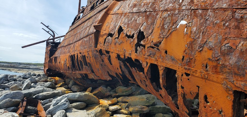
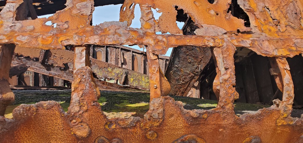
My destination was the beached shipwreck of The Plassey. In 1960, the 600 ton cargo ship ran ashore in the midst of a storm, and while the crew and cargo survived (thanks to the residents of the island), the ship did not. Now it sits rusting away on the edge of the island as a reminder of the strength of this community. Whenever I travel abroad to sights like this, I’m always surprised by the lack of safety precautions. The United States would never allow people to climb up, through, or into a rusted shell like this, and while I didn’t adventure on top of the shipwreck, it was enjoyed taking my chances with an exploration within.
On the way back to the town, I walked my bike up to the highest point of the island. Up the steep road lies the ruins of O’Brien’s Castle. Built in 1400, the castle stood solid for over 200 years until it was taken over by the O’Flaherty Clan in 1582 and sacked by Cromwell in 1652. Besides marveling at the stone construction of the building and watching kids scramble up its walls, this site also provides stunning 360 views of the island and sea beyond.

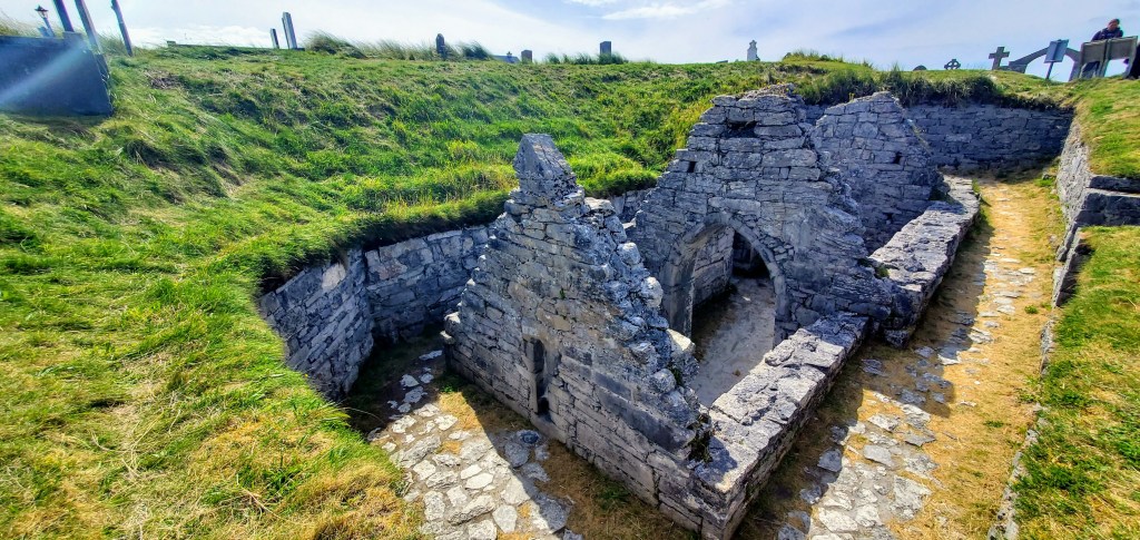
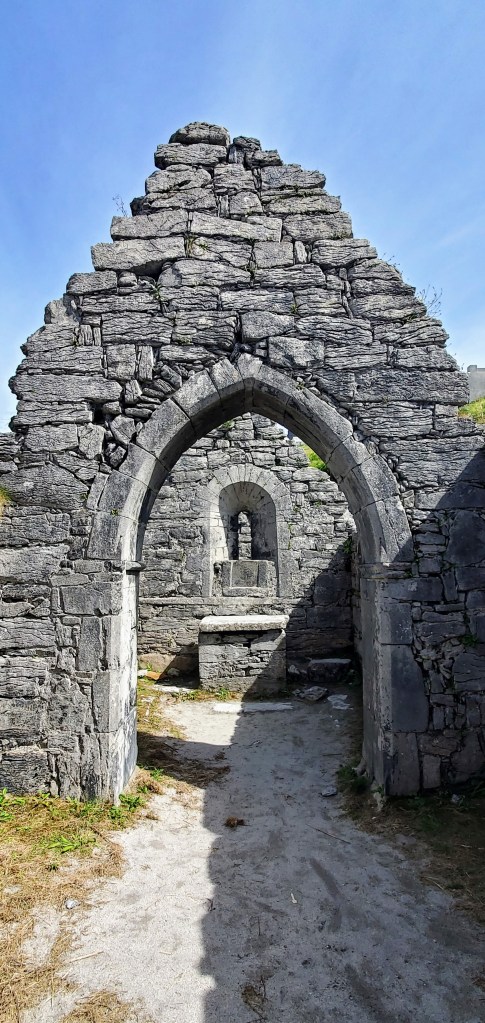
Below the castle ruins are the ruins of St. Kevin’s Church (Teampall Chaomhain). The church dates back to the 10th century, and over time the Atlantic winds have continuously buried the church in sand. Each year on June 14th – St Kevin’s Day – the locals gather to excavate the church from the winter sands. Currently, the ruins sit 6 feet below the ground. Surrounding the church is the island’s graveyard, where gravestones from the past stand next to those of the present.
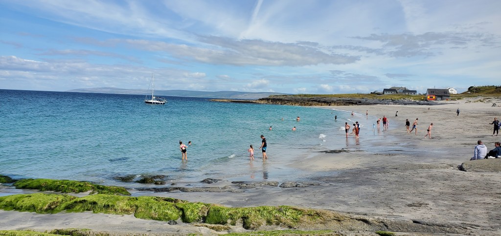
Blue Flag beach sits adjacent to the main pier and surprisingly offers soft sand and turquoise blue waters. While I visited in August, Ireland is not known for its warm temperature, so I was happy to just put my feet in the water. However, for locals this is the swimming season, so there were several people braving the cold water and relaxing on the beach.
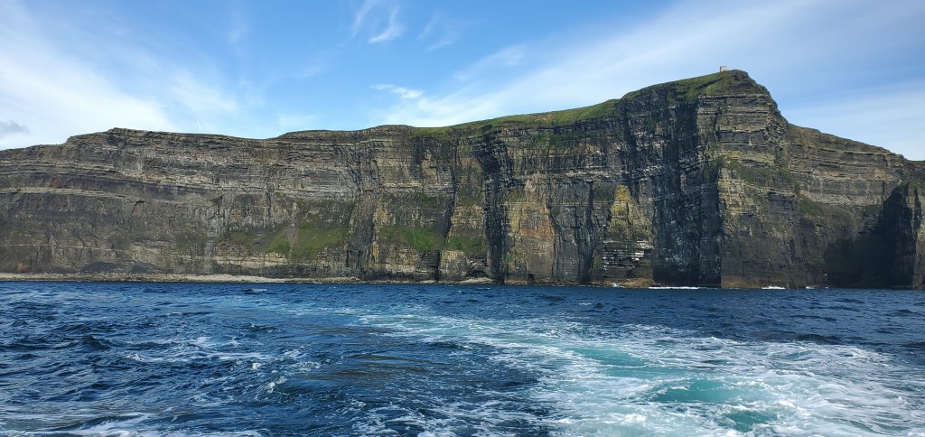
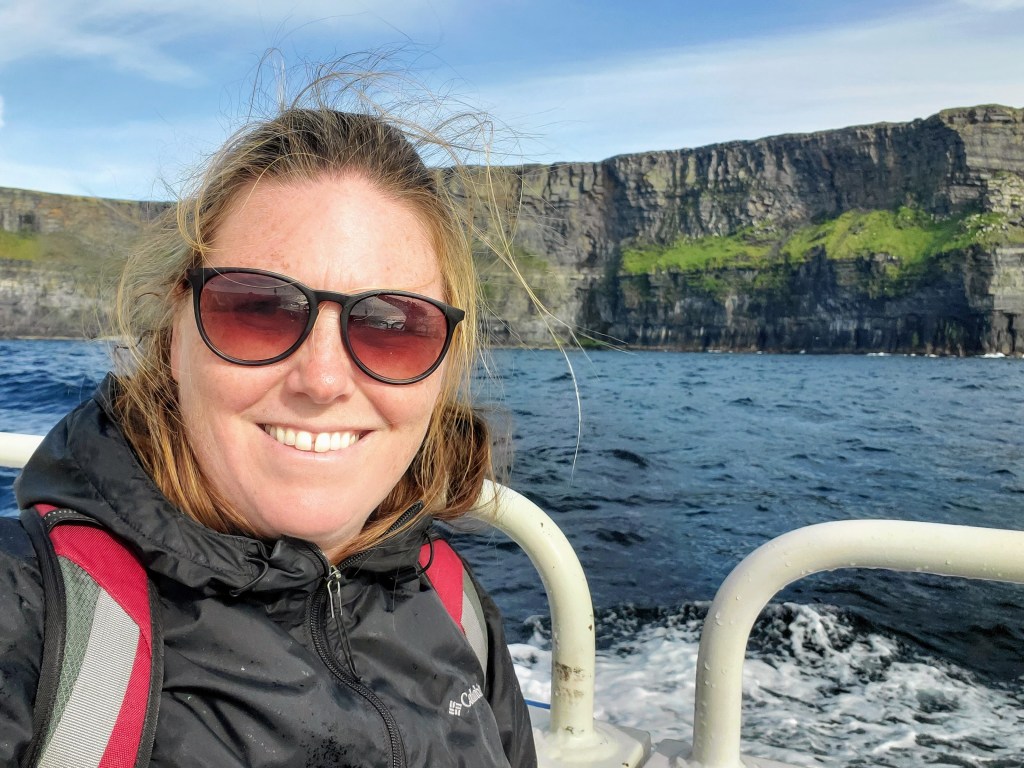
When booking my boat ride, I had the option to add on a Cliffs of Moher scenic ride, which I happily did. The one hour boat ride parallels the cliffs and puts in perspective the majesty of their height and colors. At their highest point, the Cliffs of Moher rise 700 feet (214 meters) out of the water. The varied colors of the stone and layers of moss hint at the history of the cliffs. My plan was to walk these cliffs the next day, so I enjoyed getting a preview of the trip and seeing them from a different perspective.

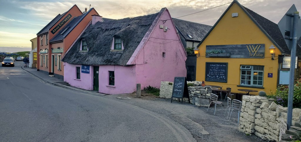
After a long day, I was happy that my lodging was just behind Doolin’s historic village center. Over the stone bridge that traverses the small Aille River, about a dozen colorful houses stand in a line offering a few pub and shopping options. Doolin is known for its music scene, and it did not disappoint. Live music emanated from every pub, and tables were set up outside of the pubs to create a cohesive community of people enjoying the music, food, drinks, and each other’s company.


Leave a comment