
East Bay Bike Path
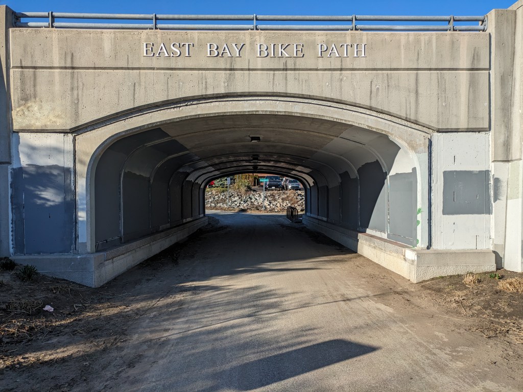
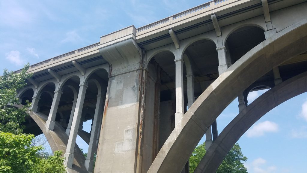
If you’re visiting Rhode Island, and you’re only going to ride one bike path, this is the one. The 14.5 mile paved path runs from Providence to Bristol. Outside of the massive hill in East Providence, the ride is flat and easy. Most of the ride hugs the coast, giving views of Providence River and Narragansett Bay. The northern end starts at India Point Park, which is a nice place to walk around in itself. However, my usual route starts across the bridge in East Providence (easier parking and access to the highway). From here, I ride about 10 miles to Warren center. This section of the bike path includes beautiful views of the water, the Pomham Rocks Lighthouse, and a few small parks. The Warren is a cute small town that offers a handful of eateries, galleries, and local stores. I enjoy grabbing lunch and walking the town center before hopping back on my bike.
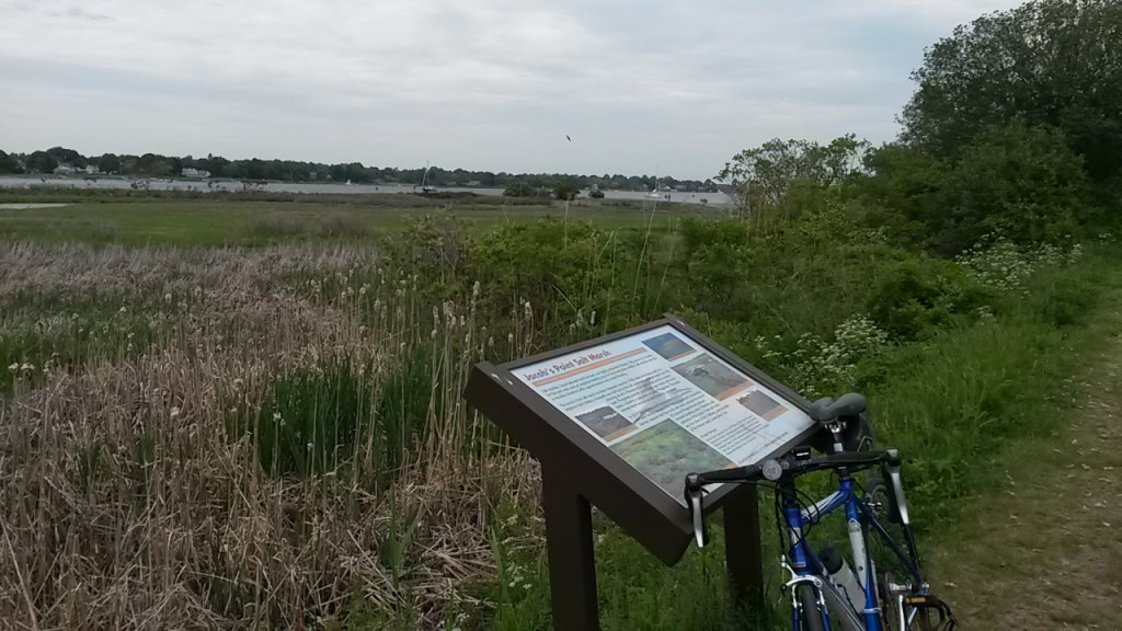
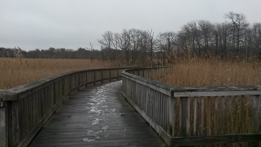
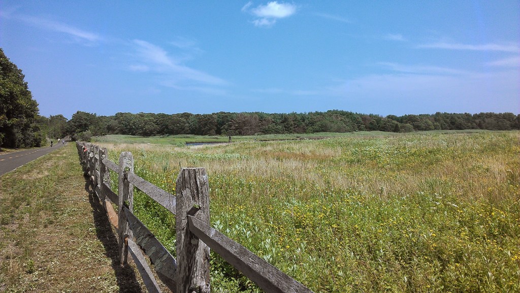
However, if you have the energy and time, riding all the way to Bristol offers some other lovely stops. Between Warren and Bristol, the bike path rides along the marshy coast. Don’t miss a quick stop at The Audubon Society of Rhode Island’s wooden boardwalk that goes out into the marsh and has views of osprey nests. Just outside of Bristol center, Colt State Park is a must stop as well (and really has enough to warrant its own visit). The park offers walking trails, picnic areas, views of the bay, the Coggeshall Farm Museum, and a small swimming beach.
The southern end of the bike path ends in Independence Park, just outside of Bristol center. Bristol is one of the cutest towns in Rhode Island – with a few blocks of local shops, nice eateries, and harborside paths – it’s easy to spend a whole afternoon exploring this downtown.
Blackstone River Bikeway
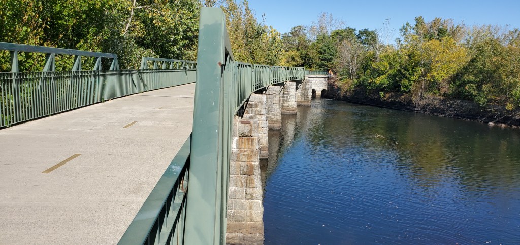
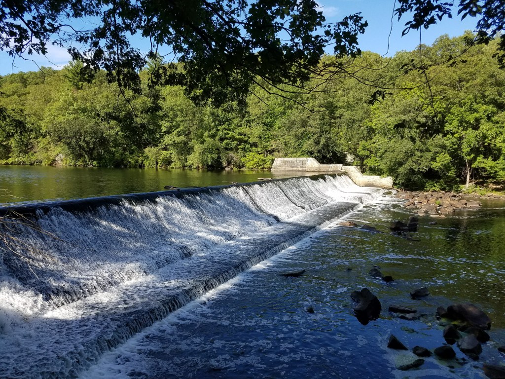
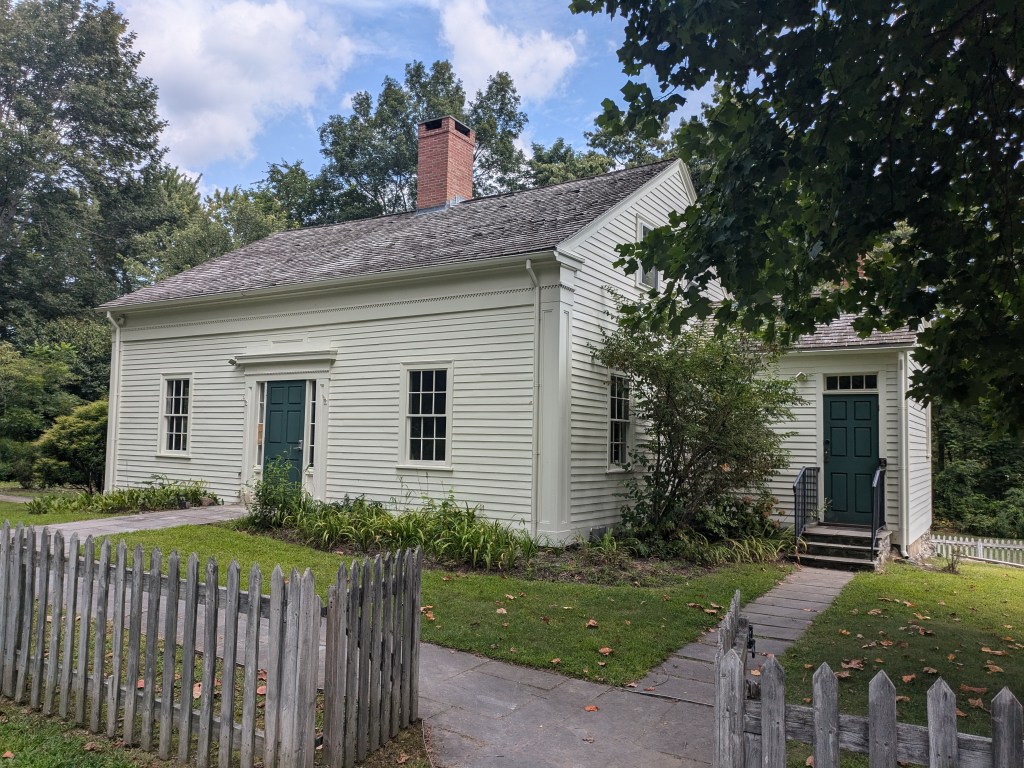
This is my favorite of all the Rhode Island bike paths. It is a beautiful ride that follows the Blackstone River. There are several places to stop and relax on nice benches overlooking the river, including a viewing platform that looks over the Manville Dam. Also, there is a small museum, Captain Wilbur Kelly House Museum at the Ashton Mills bridge which gives a glimpse into the history of transportation in the are. More importantly, during the course of the ride, you only have to cross one main road, otherwise it is 10 miles of uninterrupted riding on a well paved path. There’s only two major hills along the ride, so for the most part its an easy trip from end to end.
When I lived in Providence, I parked at the Blackstone Valley Greenway lot in Lincoln and rode the 10 miles to the River’s Edge parking before turning around. Now that I live in Massachusetts, I do the reverse. There are no amenities, town centers, or eateries along the bike path – this is purely for the ride and the views of the river. The bikeway does continue past Lincoln to Pawtucket, but it’s more urban and harder to follow after Lincoln.
Washington Secondary Bike Path

While the Washington Secondary Bike Path doesn’t have a lot of frills – with nice views or interesting stopping places – it is the longest bike path in the state, and it keeps getting longer. Right now it starts in Cranston behind the Lowe’s parking lot and runs for 19 miles to rt 102 in Coventry. There are plans to connect this to the Moosup Valley State Park Trail in CT.

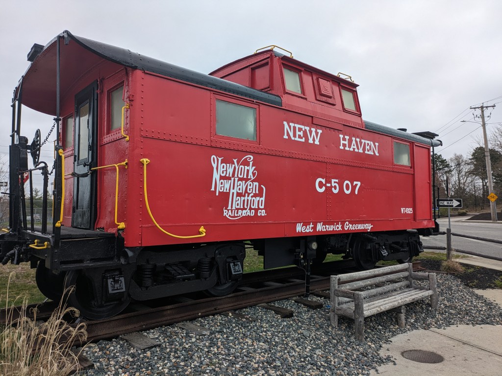
At the northern end of the trail, the path parallels urban areas and busy roads. As the path continues South, it becomes a quieter ride as it passes rivers, restored mill buildings, and woodland areas. One stop not to miss along the way is the New Haven Railroad Car. Set in a random parking lot near the West Warwick Skate park is an old Caboose car from the New Haven to New York City train line. I’ve looked online to see if I can learn about how and why it is here, but can’t find anything. Either way, its a fun find along a rather unremarkable bike path.
Woonasquatucket River Greenway
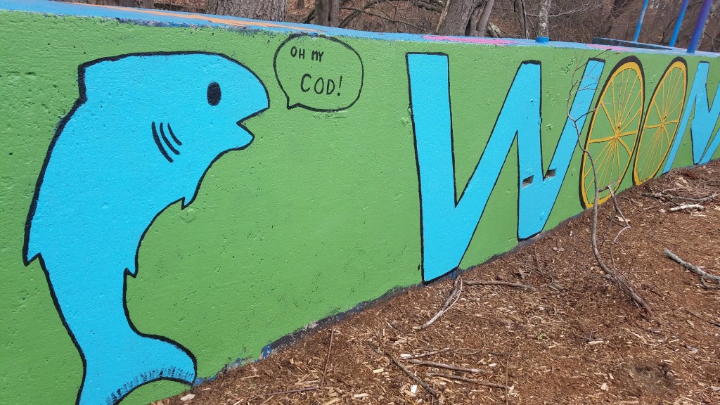
When I lived in Providence, this was a bike path I could access from my house. At only 5 miles long, it’s not a route to go out of your way to check out, but it does work as a nice reprieve from the chaos of Providence and Olneyville. The bike path starts as a bike lane behind the Providence Place Mall, but turns into a separate bike path in Olneyville. From there is travels into Johnston along the river. It passes two skate parks, Merino park, and the Dyerville State Golf Course. The highlights of the path are the murals painted by local school children.
Quonset Point Bike Path
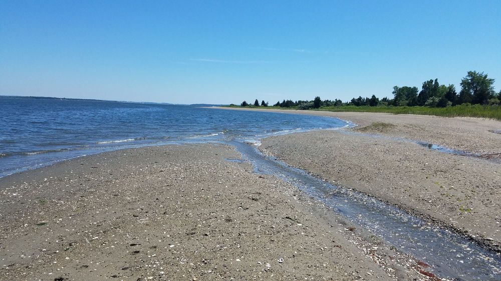
At just 3.7 miles one way, this is not a bike path I frequent with my bike. However, if you have young kids, I can imagine this being a great starter path as it is short, flat, and free of street crossings. What makes it worth a visit in general is that it ends at Calf Pasture Beach. Since this is a beach that has no public parking, walking or biking here via the bike path is the only way to access it. Since I am usually walking this route, I tend to start my trek from the parking area off of Marine Ave in North Kingston; from here it is a scenic 1.5 miles next to vast fields to the beach.

Leave a comment